YACANA · EXPEDITION DOSSIER · AJUSCO LAT 19.2130°NLON 99.2570°W
Ajusco · Pico del Águila

Mexico City's
own mountain.3,937 m / 12,917 ft

Half a day. 45 minutes from CDMX. Pine forest, volcanic rock, and the entire Valley of Mexico under your feet. The first mountain on the path.

  • Duration1/2 day
  • Difficulty2/5 accessible
  • Elev. Gain~600 m
  • Distance5 km RT
  • Tech.Hike
  • SeasonYear-round

What you're really signing up for.

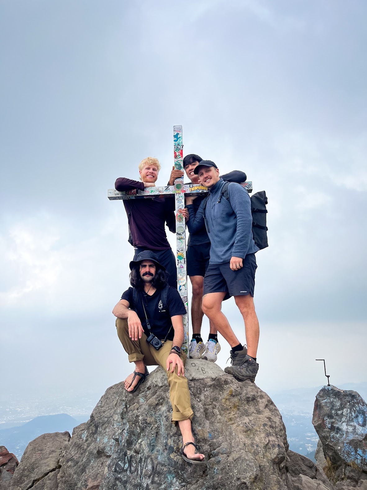
"Ajusco is where you find out if altitude affects you. Half a day, 45 minutes from CDMX, real mountain at the end of it."

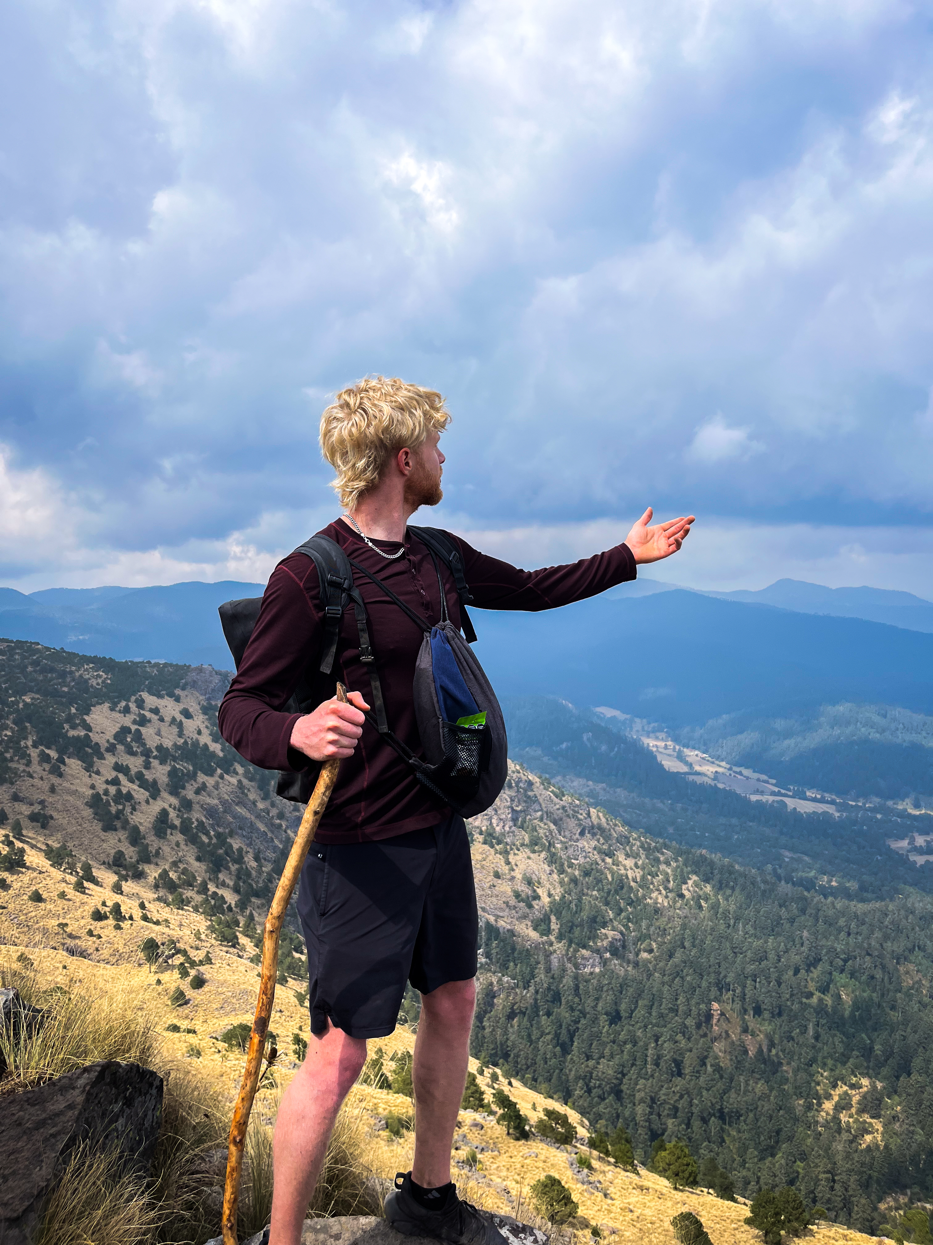
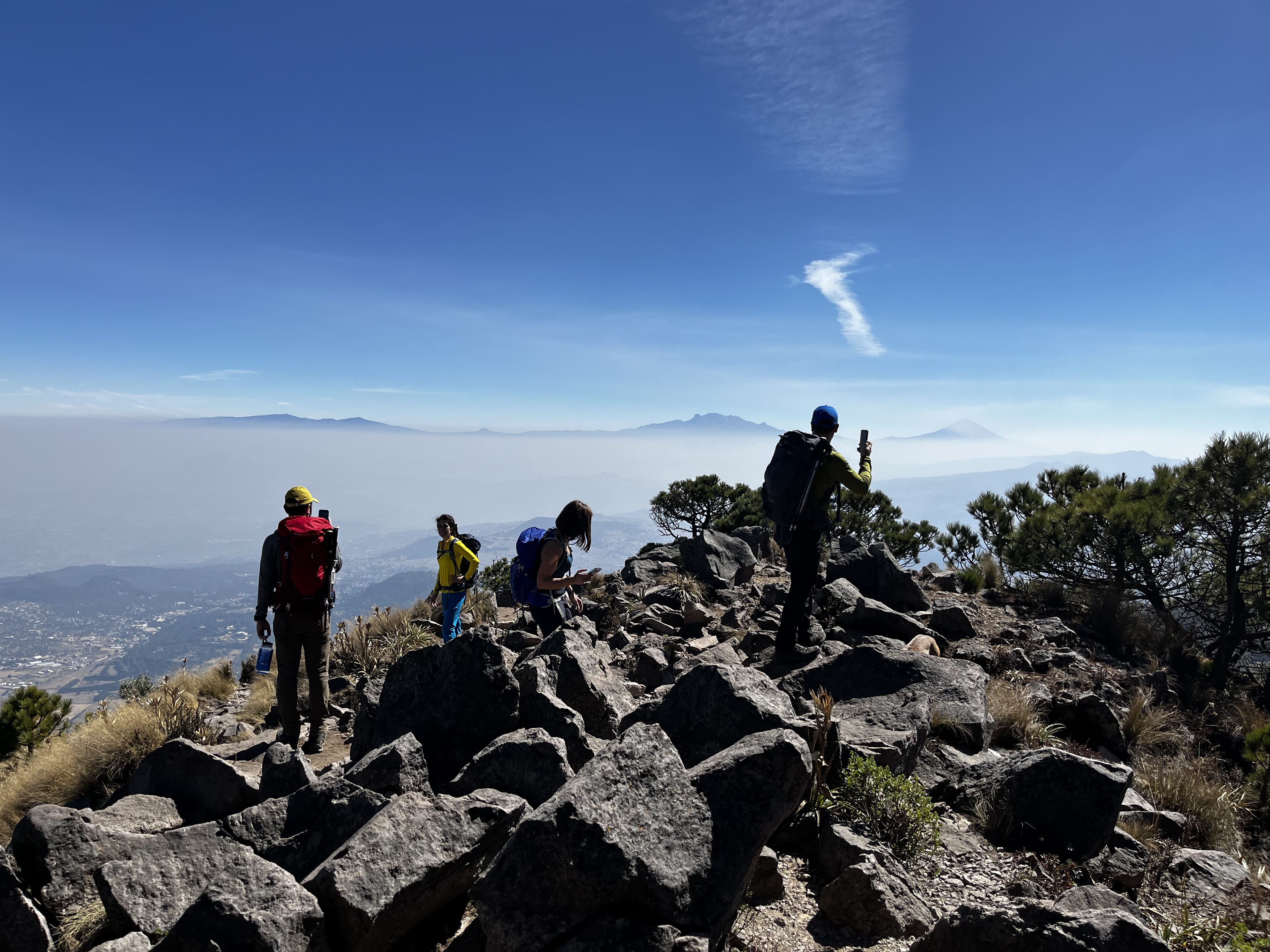
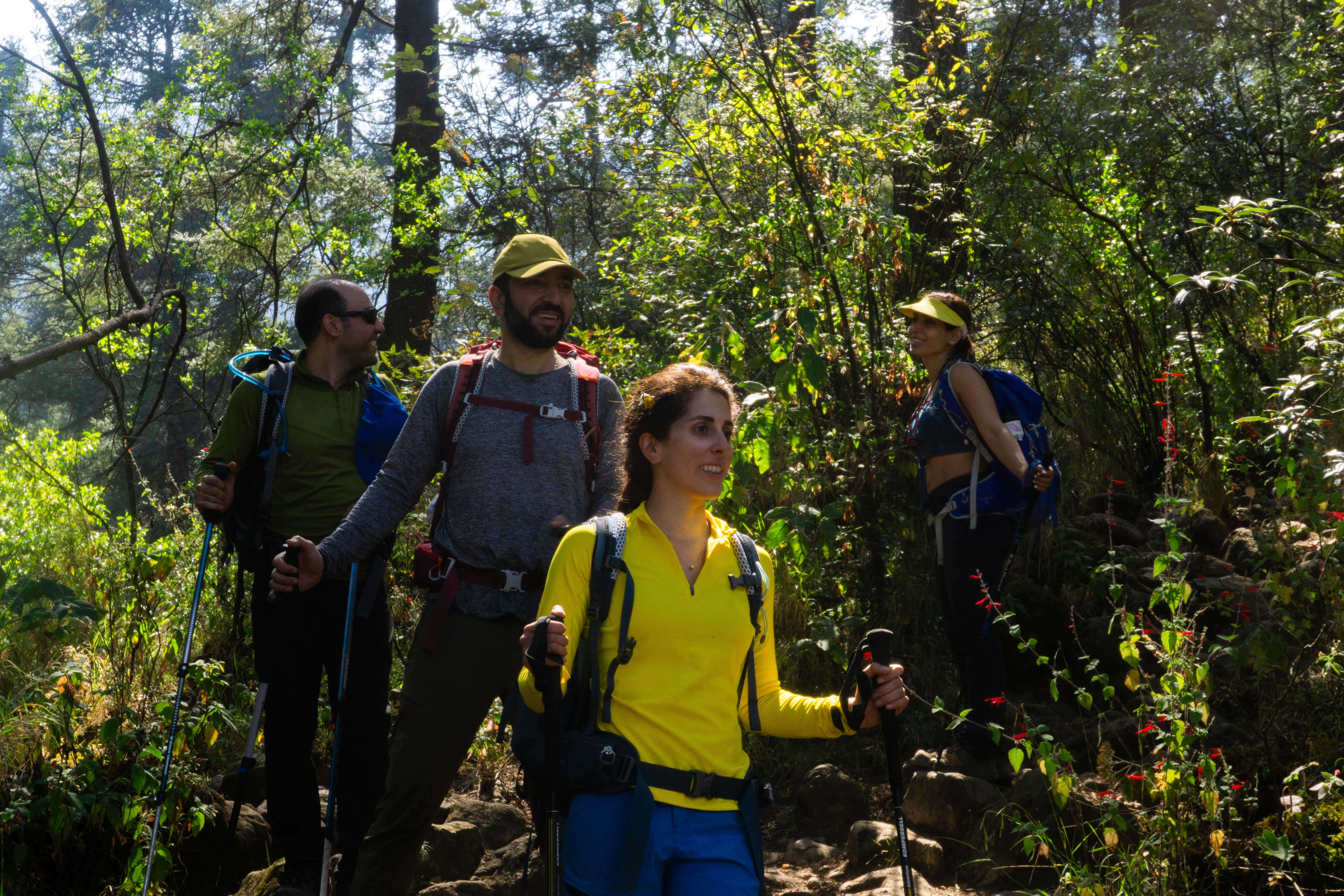
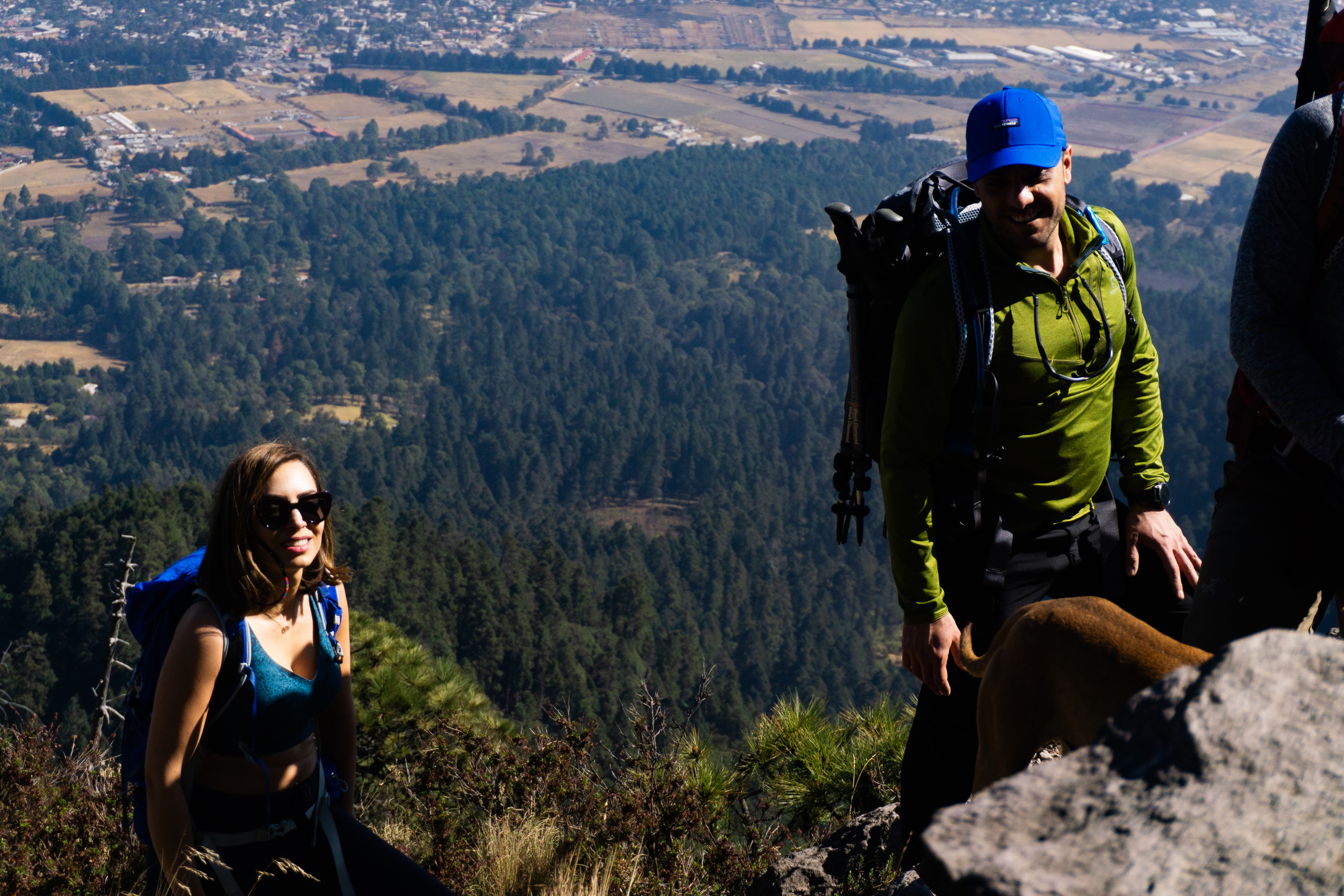
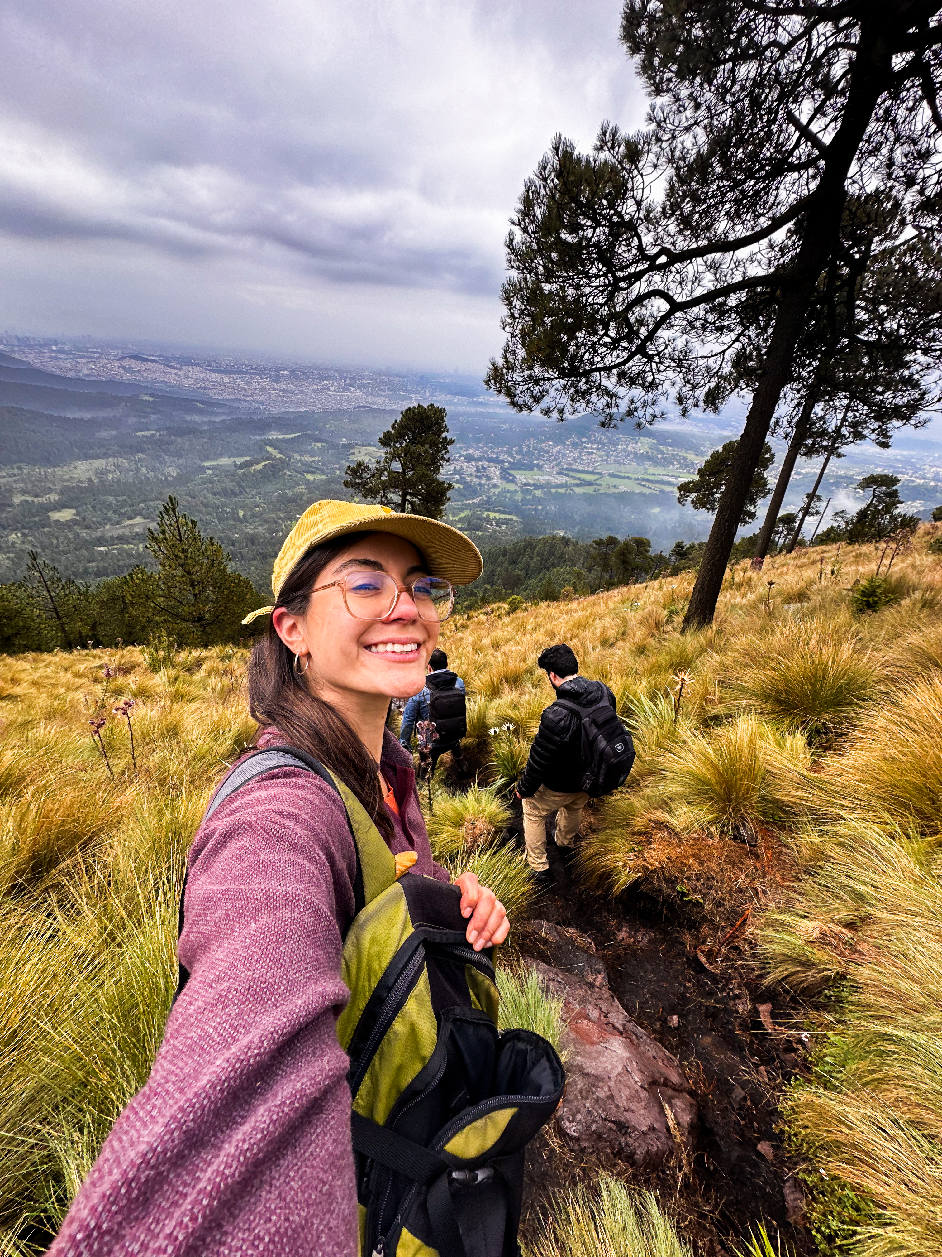
Ajusco is the closest mountain to Mexico City. The trailhead at Albergue Alpino Ajusco (3,300m) is technically inside CDMX limits, in the Tlalpan borough — about 45 minutes south of Polanco or Roma by car. From there, the trail climbs through pine forest and onto volcanic rock to the summit at Pico del Águila (3,937m).

The hike is short — about 5km round trip with around 600m of elevation gain — but it's not flat. The final kilometer to the summit gains 300m on loose volcanic rock, with some hands-on sections. Most climbers do this in 4–5 hours total. Half a day, including the drive and a celebration meal.

For visitors planning to climb Pico, Izta, Malinche, or Nevado, Ajusco is the natural first day. You'll learn how your body moves at altitude, you'll test your gear, and you'll see the bigger mountains from a vantage point you can't get from the city. It's also a complete experience on its own — not every visitor needs to summit a 5,000m peak. Pico del Águila is a real mountain with real views.

Every meter, plotted.

From CDMX pickup at 2,250m to Pico del Águila at 3,937m and back — the altitude curve of a typical Yacana Ajusco morning.

4000m3500m3000m2500m2000m
CDMX 2,250m
Trailhead 3,300m
SUMMIT 3,937m
07:0007:4508:3009:3010:3011:3012:3014:00
Descent Ascent Above 3,500m

Hour by hour.

07:00CDMX
2,250m · pickup
Departure from your accommodation
Coffee in hand. Drive south through Tlalpan. Forty-five minutes through the city to the trailhead.
07:45Trailhead
3,300m · gear check
Albergue Alpino Ajusco
Park entry, gear check, brief walk-through of the day. Cross the rope bridge at the start of the trail.
08:00Pine forest
3,400m · ascent begins
Up through the trees
First kilometer is gentle forest hiking on a well-marked trail. Steady pace. The altitude is already noticeable but manageable.
09:00Treeline
~3,600m
Out of the forest
The pines thin out. The summit appears in full view. The trail steepens and becomes rockier. From here you can see the city laid out below.
09:30Final climb
3,800m · loose rock
The hardest 30 minutes
Steep loose volcanic rock. Some hands-on sections. Slow steady pace. The altitude makes this section harder than it looks on paper.
10:30Summit
3,937m
Pico del Águila
Mexico City's highest peak. The entire Valley of Mexico spreads below you. On clear days you can see Popocatépetl and Iztaccíhuatl to the east, Nevado de Toluca to the west. Twenty minutes on top.
11:00Descent
3,800m
Back down the steep section
The loose rock is harder going down than up. Trekking poles do real work here. Watch your footing.
12:30Trailhead
3,300m
Back at the truck
Boots off, layers off, water. Quick decompress before the drive back.
13:00Local restaurant
~2,800m · lunch
Celebration meal
Real Mexican food at a restaurant near the park. Cold drinks. Trade summit stories.
14:00CDMX
2,250m · dropoff
Home by mid-afternoon.
Drop-off at your accommodation. The rest of the day is yours. Most clients use the afternoon to rest or explore the city.
// A note on timing · These are typical times. Actual pace varies with group fitness, weather, and how the day unfolds. Some groups summit earlier. Some take longer. The plan flexes to match the climbers.

What to bring, what we provide.

Ajusco is the most accessible mountain we offer. Standard hiking gear works fine — no specialized mountaineering equipment needed. Two columns: yours, ours.

You bring

PERSONAL
  • Hiking boots or trail shoesBroken in. Good traction matters on the loose rock near the summit.
  • Base layer topSynthetic or merino. Avoid cotton.
  • Mid layer fleece or light puffyThe summit is cooler and windier than the trailhead.
  • Windbreaker or rain jacketLightweight, packable. Hood preferred.
  • Hiking pants or leggingsBreathable, moves easily.
  • Light glovesOptional, depending on season. Useful for the rocky scrambling section.
  • Cap or sun hat + warm beanieBoth. Sun protection on the way up, warmth at the summit.
  • SunglassesUV protection. The sun at altitude is stronger than you'd think.
  • Daypack 15–20LFor your layers, water, snacks, camera.
  • Water bottle or bladder1–1.5L minimum.
  • Sunscreen + lip balm SPF 30+Especially for the summit ridge.

We provide

INCLUDED
  • Trekking polesStrongly recommended for the rocky descent.
  • Garmin inReach beaconLive GPS tracking + emergency SOS.
  • Group first-aid kitCarried by the guide.
  • Snacks during the hike + celebration mealTrail snacks, then lunch at a local restaurant after.
  • Round-trip transport from CDMXYour accommodation to the trailhead and back.
  • Park entry feesCumbres del Ajusco National Park access.

// Personal gear rentals · Need to rent boots, a jacket, or a daypack? Tell us when you book and we'll arrange it through our partners in CDMX. Reserve 7+ days out so sizing works.

What it's like up there right now.

Modeled summit conditions, refreshed when this page loads. Rounded estimates — we use this same data alongside on-site verification to call go/no-go on the morning of your hike.

Modeled
Summit Temp
Loading…
Modeled
Summit Wind
Loading…
Modeled
Today's High / Low
Loading…
Modeled
Hiking Window
Loading…
Sunrise on Trail
We start the hike well after sunrise on Ajusco.
Trail Status
Verified day-of
Park access and trail conditions confirmed by your guide on the morning of the hike.
Data: Open-Meteo · ECMWF model · Modeled summit estimates, not station-measured.

What people say after they climb with us.

Verified reviews from Yacana climbers across our expeditions. 50+ five-star reviews on TripAdvisor — here are three.

★★★★★
"Cristino is the best, most experienced guide you could ask for."

We had an amazing time. Cristino goes above and beyond — just a genuinely warm person. Super well-organised: transport, food, technical gear. Everything is arranged perfectly. We would definitely do it again.

Julie S.via TripAdvisor
★★★★★
"Knowledgeable, friendly, and funny — the best guide we could have wished for."

The company was always very quick to respond to all my questions, and helped me with everything I needed. Our guide was the best we could have wished for: knowledgeable, friendly, and funny. He knows lots about the history of Mexico.

Andrea M.via TripAdvisor
★★★★★
"One of the toughest hikes I've done. They took great care of us."

Cristino took great care of us, helping set up tents, cooked, and more importantly motivated us even when we felt discouraged halfway. Wonderful experience overall. I would recommend doing it with this company.

Shawnleetchvia TripAdvisor

Where Ajusco fits.

Ajusco is the natural starting point. Many clients climb it as their first introduction to Mexico's mountains, then progress to higher peaks. Here's the full progression Yacana recommends for climbers building toward Pico de Orizaba.

Pricing.

Ajusco runs cleaner per-person rates because it's a half-day with a single guide. The pricing scales by group size.

Deposit — 35% secures your guide and date.

Balance — 65% due at the END of your trip.

Cancel — 14+ days out: full refund. Inside 14 days: no refund.

Cards — +5% bank fee on remainder. Cash welcome.

Solo climberUSD$445
2 climbersUSD$275/pp
3 climbersUSD$195/pp
4+ climbers BEST RATEUSD$165/pp
Included Round-trip transport from CDMX · English-speaking certified guide · trekking poles · trail snacks + celebration meal · park entry fees · live GPS tracking · emergency satellite comms.

Want to add Cruz del Marqués?

The standard Ajusco hike goes to Pico del Águila. But the area has a twin peak right next to it — Cruz del Marqués (3,930m), connected to Pico del Águila by a saddle ridge.

Adding Cruz del Marqués to the hike turns the half-day into more like 6–7 hours, with another 300m of elevation gain on the saddle traverse and a second summit. It's a worthwhile add-on for anyone who wants more time on the mountain — both peaks are visible from CDMX, and many local hikers consider summiting both the "complete" Ajusco experience.

Tell us when you book that you want both peaks and we'll quote it.

The questions everyone asks.

Moderate. About 5km round trip with roughly 600m of elevation gain over 4–5 hours. The trail is short but steep, with loose volcanic rock near the summit. No technical skills required, but the altitude (the entire hike happens above 3,300m) makes it harder than a comparable hike at sea level.
No previous mountaineering experience required. Basic hiking fitness is sufficient. Ajusco is the most accessible mountain we guide. If you can comfortably hike for 3–4 hours with some steep sections, you're ready.
Yes — it's the natural first step. Many clients use Ajusco as an acclimatization day before Pico de Orizaba, Iztaccíhuatl, La Malinche, or Nevado de Toluca. It's also excellent for active recovery between harder climbs or as a warm-up if you're returning to altitude after time at sea level.
Very close — about 45 minutes south of central CDMX by car, depending on traffic. The trailhead at Albergue Alpino Ajusco is technically inside Mexico City limits, in the Tlalpan borough. This makes Ajusco the most accessible mountain we offer and the perfect half-day option.
Less common on Ajusco than on the higher peaks, but still possible above 3,500m. Spend at least 1 day in CDMX (2,250m) before. Tell your guide immediately if you feel a headache, nausea, or dizziness. The hike is short enough that descent is always quick if needed.
Yes, on request. Cruz del Marqués (3,930m) is Pico del Águila's twin peak, connected by a saddle. The full circuit adds about 2–3 hours and another 300m of elevation gain. Mention it when you book if you want both peaks.
Year-round hiking is possible. November through March offers the clearest views and most comfortable temperatures — on clear mornings you can see Popocatépetl, Iztaccíhuatl, and even Pico de Orizaba in the distance. Rainy season (June–September) brings afternoon storms, so we start earlier and watch the sky carefully.
Basic cardio and some hill walking is enough. If you can hike briskly for an hour with moderate elevation gain, you're ready. Practice on stairs or treadmill inclines if you don't have hills nearby. The biggest factor is altitude, not fitness.
Your lead guide calls it. Ajusco gets afternoon clouds and rain in summer, occasional snow or ice in winter. If conditions are unsafe — lightning, severe wind, whiteout — we delay or turn around. Safety first.
Yes. Tell us when you book what you need — boots, jacket, daypack — and we'll arrange rentals through our partners in CDMX. Reserve 7+ days out so sizing works. We provide trekking poles at no charge.
Maximum 4:1 climber-to-guide ratio for Ajusco, though larger groups can be accommodated with a second guide. Most hikes are 2–6 people total. Smaller groups mean a faster pace and more attention from your guide.

Let's climb.

Tell us when you're coming. We'll handle the rest.